DEAD Planning
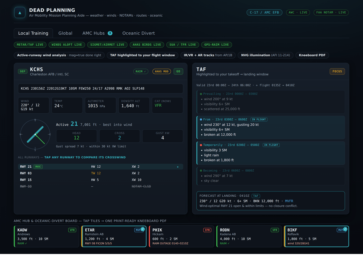
One-stop mission planning for air-mobility / C-17 sorties — weather, NOTAMs, hazards, oceanic routing, and wind/pattern analysis that picks the active runway, computes head/cross/tailwind components, and cross-references NOTAM runway closures against the wind-optimal runway.
What it does
An EFB-style sortie brief that consolidates everything a mission planner cross-references by hand:
- Weather & winds — live METAR/TAF from NOAA AWC, with density altitude and ISA deviation computed locally. The wind engine does per-runway head/cross/tailwind analysis, correctly converting true-wind METAR data against magnetic runway designators using surveyed true headings.
- NOTAMs — live FAA notices (OAuth2 NMS-API or legacy endpoints), categorized and ranked, with runway closures cross-checked against the wind-optimal runway so the recommendation is always a usable runway.
- Hazards & airspace — TFRs, MOAs/Restricted/Warning/Alert areas, convective outlooks, AHAS/BAM bird-strike risk, PIREPs, and GPS-RAIM outage windows, all feeding a GO / CAUTION / NO-GO status.
- Strategic routing — a Global tab with multi-leg planning, wind-corrected ETAs, equal-time-point calculations for oceanic diversions, and NAT/PACOTS track integration. Military extras include MTR and air-refueling track lookup with winds computed at the appropriate altitude block.
- PDF kneeboard — a print-ready, light-theme brief with a scan-first divert summary table.
How it’s built
Deliberately zero-dependency: the backend uses only Node built-ins, the frontend is vanilla JavaScript, and the map is a custom slippy-map implementation with NEXRAD overlay — no framework, no bundler, no map library. The deployment sandbox blocks native postinstall binaries, so the constraint became the architecture. Data modules pull from FAA, NOAA AWC, Open-Meteo, and OurAirports (with a curated airports.json and an ingest script for refreshes); DoD DAIP feeds power the oceanic features via DoD-PKI certificates. The core analysis engine is unit-tested with node:test.
Operational philosophy
It’s a planning aid, not an authority — every screen says verify with official sources. Anything the app can’t fetch live is reported UNAVAILABLE rather than estimated, because a guess dressed up as data is the most dangerous thing a planning tool can produce.
// more flying apps
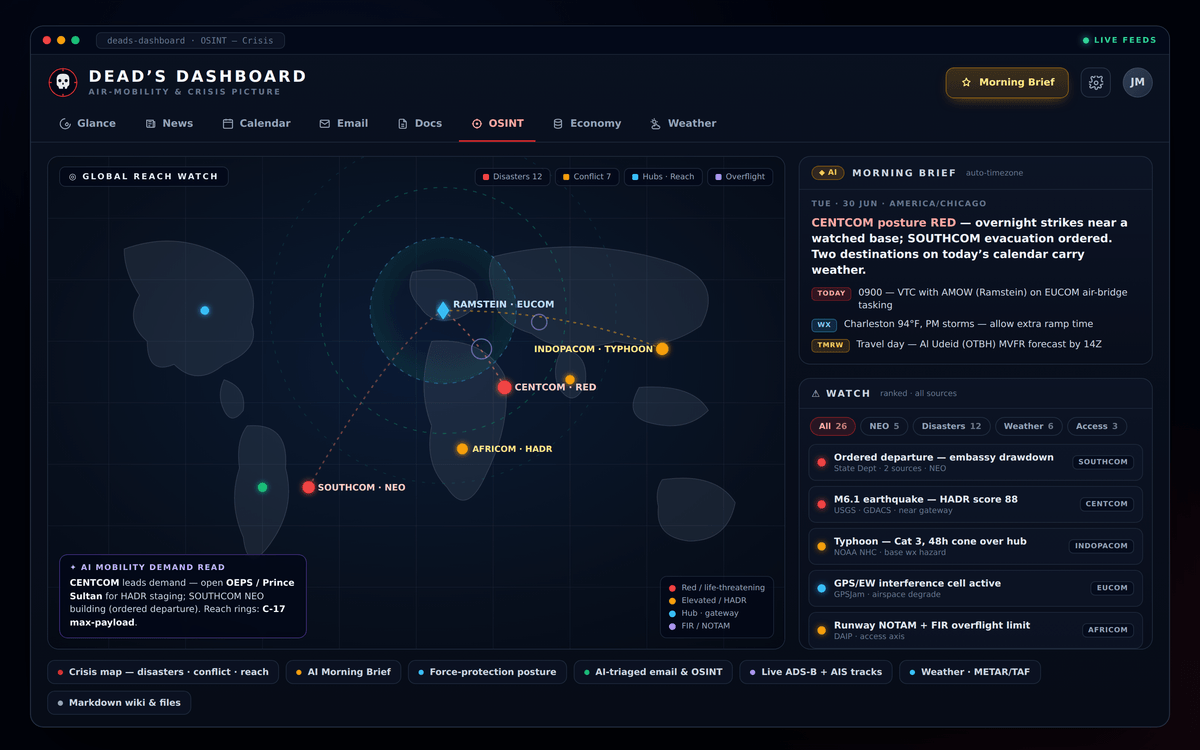
DEAD's Dashboard
A single-user air-mobility / crisis-planning dashboard that fuses national-security news, email, calendar, open-source intelligence, and a live crisis map into one operational picture. Built with Next.js 15 and managed MySQL.

Mission Data Card
A single-file, offline mission data card for C-17 pilots — open it on an iPad or in a browser, fill in the pre-flight card, and everything you type saves locally on the device. No network, no accounts, no servers.